Friday 28 January 2011

Tarutao National Park

I think I have found my favourite island in Thailand - Ko Tarutao is the largest of the islands in the Tarutao National Park, is 26.5km long, and 11km wide. The highest point is over 2,000 feet. Rain forest covers over 60% of the island. The many beaches are stunning, silver, long and very wide at low tide. The dry beach sand is silver and crunches like fresh snow underfoot.

The only development on the island is a cluster of government-run bungalows by the ranger station at Ao Pante Malacca. There was a good Thai restaurant near the ranger station. It would appear that alcohol is not served at the ranger station. This was not a problem for me as I had a good stash on board the boat.

The party island of Ko LIpe is only around 20 miles away to the south west. Duty free Langkawi is also around 20 miles away to the south. Fast ferries arrive several times a day from the Mainland (Saturn) and Ko Lipe. The Thais don’t mess around when it comes to powering boats – I managed to snap a shot of one of the fast ferries with five 225 horse power outboards on the back.


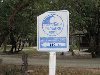
There was a steel post on the beach marking the height of the 2004 Boxing Day Tsunami at 4.5 metres. There were the Tsunami evacuation signs pointing people in the direction of high ground. These signs were very evident on all the islands that I had visited in Thailand.


I motored in the dingy down a river for just over a mile to visit the Crocodile cave – a 200 metre long cave used by smugglers in the past.
Fortunately, I had been told to take a head lamp or torch as once into the cave proper it was deepest pitch black. I helped myself to one of the large green plastic kayaks at the entrance of the cave and paddled into the darkness. Some of the caverns that lead off from the main passage were huge. At one point I turned off the headlamp to experience the darkness, other than the occasional ploop of water dripping from the stalactites and the squeak of a bat, it was very very dark and very quiet. Perish the thought of the torch failing as you’d have to wait until someone else came through before you could get out. That did not appear to be too often as I had the darkness to myself along with the myriad of bats that I disturbed along the way.

I spent a very pleasant few days exploring parts of the island of Ko Tarutao. I hope to get another opportunity to visit another part of the Tarutao. Eventually, I had to haul the anchor and head for Langkawi. I arrived at Bass Harbour Kuah, Langkawi at 18:30 on February 2, having change the time forward one hour (+8.00 UTC).

Wednesday 26 January 2011

Phuket to Langkawi

I Cleared Customs and Immigration at Ao Chalong, Phuket Monday January 26, then at 6.30am the following day headed for Ko Lanta a trip of some 40 nautical miles. There was a good 15 to 25 knot east north east wind for most of the trip, which meant I was able to give the motor a well earned rest. It also meant if was beating to windward, something I had not done for awhile. The seas were not that deep, less than 50 metres, which made for short, sharp and choppy waves with the more than odd green wave with white spume crashing down the deck. This was a good test for the deck leaks – I’m pleased to say that the worst deck leak, near the anchor locker, is now fixed. After making several tacks I finally arrived at the south end of Ko Lanta at 21.00. Going into an unknown anchorage at night is not recommended and is something I try to avoid wherever possible. Thank goodness for the Standard Horizon CP500 GPS Chartplotter. I could see the anchor lights of several other yachts in the small bay. The anchorage was not the best as a swell came around the southern tip of the island making for an uncomfortable night.

The next day I departed Ko Lanta and heading for Ko Muk/Mook as I thought it was worth a second look. This was an easy sail of 15 nautical miles. I found a secluded, very sheltered bay to the west of the Ko Muk and rested up there. I had planned in visiting a deep cave that you have to swim to get to. However, one look at the queue of life jacket clad tourists in the boats around the cave entrance quickly convinced my otherwise.


At just after 6.00 on Saturday morning January 29 I hauled the anchor and headed south east to ward Ko Tarutao some 40 nautical miles away. Initially there was very little wind and I motored sailed trying to maintain 4 knots to make for a good passage.
I was none to keen on finding anchorages in the dark again. At around mid day when I was near Ko Phetra the wind picked up and was blowing 15 to 20 knots from the north east. I was able to give the motor a rest again and sail doing 4.5 to 5 knots of speed. The island formations in this area are amazing with huge tree topped granite structures rising vertically out of the water like colossal pillars several hundred feet high. The wind steadily increased with gusts up to 30 knots Sadiqi was making 6 knots through the water on occasion.
The short sharp swell hindering her at times. Smithy (Windpilot) was doing an exemplary job of steering the boat in trying conditions. I sailed passed Ko Bulon Le where I had stopped before.

At 16.30 I dropped the anchor in a sheltered Ao Pante Malaka on the north western end of Tarutao island. It had been one of the best sailing days I’d had for ages as there was a decent breeze. There was only one other yacht in the bay. Franz, who I met before on Lankawi, came by with his two young sons to say good day on their way to the beach.

Saturday 15 January 2011

Ao Chalong and the chores

Planning preparation and provisioning for the next leg of the adventure:
Repairing sails – patching the staysail.
Servicing winches and equipment.
Replacing some running rigging – wear and tear and chafing of sheets.
Finding a suitable place to haul Sadiqi out of the water for hull maintenance.
Fixing slow air leaks in the dingy.
Finding and fixing deck leaks – still!

Rex from “Pequad” met up with me briefly. I mentioned I’d called my outboard motor after him “Sepo Rex”, and advised him that if his ears were ever ringing it would be me cursing his namesake. The outboard still sounds like an angry little cement mixer. His generosity and gratitude for rescuing “Pequad” knew no bounds and was non existent. Hopefully he is more adept at anchoring than he has been on his way back to the states via Madagascar and Africa.

Working on the leak in the fore cabin again! This time I removed the starboard forward part of the wooden rubbing strake to seal the leaks. This was no easy job. First I had to find a relatively sheltered anchorage and that was not Ao Chalong in a north easterly breeze. I motored over the Ban Nit, just over a mile away on the north eastern side of the bay. I did find one likely candidate for the fore cabin leak. One of those boat building undocumented design features – a hole drilled through the hull covered by the wooden rubbing strake, that went through to the anchor locker bulk head. In desperation of fixing the leak I also cut a section of the anchor locker bulkhead out where it attaches to the hull and filled it with epoxy resin.

Tuesday 11 January 2011

Similan Islands

Friday January 7 at 01.00am I set sail for Similan islands. I had hoped to get a good north easterly land breeze (beam reach) all the way to the Similan islands. For awhile I had the Asymmetrical, coloured sail up and sailing along nicely. At around midday the winds dropped and the motor was started. As we neared the northern most island of the group, Ko Similan, the heavens opened and it poured with rain, with drops the size of golf balls.

I arrived at Ko Similan, one of nine islands in the group, at 15.00 and picked up a mooring in Donald Duck Bay, a fairly sheltered bay in the North East wind. According to Rob Heikell’s Cruising Guide the only safe over night anchorage on the Similan group of islands. However, the winds had swung to the south and a swell had picked up so the boat was bouncing around on the mooring a good deal. The Similan islands, consisting of nine islands, are a national park with crystal clear water and a scuba diving haven.

I swam on the mooring to check that it would hold overnight, it was well attached to a huge bit of concrete and the water was indeed crystal clear. I went ashore to pay my dues; 400 Baht (Au$12.00)/per person and 100 Baht (AU$3.00) / day vessel fee. Had I had scuba tanks onboard I would have had to pay an additional fee. Later in the evening there were peels of thunder and flashes of lightening, all a bit too close for my liking. The boat continued to rock and roll all night, needless to say it was not the best night sleep I’d had despite being a tad tired from the 14 hour sail from Phuket.

The next day the peaceful anchorage with several other yachts and a few large live-aboard dive boats was invaded by the day tripper boats and hundreds of tourists. I had hoped that the Similan Island would be out of range of the day tripper boats with multiple powerful outboard motors, alas I was wrong. The Similan Islands are one and half to two hour speed boat ride from the mainland.

I used the Hooka/Powerdive unit to dive on the reef. The reef was generally dead with some live brain coral, there was an abundance of reef fish. I can only assume that the coral has evolved to disguise itself in drab colours to protect itself, unfortunately that is unlikely. Several years ago some enterprising fishermen used to use dynamite to catch fish and in the process destroyed the habitat – go figure. This was the first time I had used the Powerdive unit at any depth. The small compressor is powered by a 12 volt 35 Amp Hour AGM battery. I loaded all the gear into the inflatable dingy, then attached a 15 meter line, max depth, to my weight belt. Once I was below 10 metres I really had to suck on the air. It is more a breathing technique and breathing very slowly to allow the little compressor to pump air down 10 metres or one atmosphere. The problem with having scuba tanks on board is getting them filled and getting the required annual scuba tank tests etc. The Powerdive unit is simple and effective. It enables me to clean the bottom of the boat and get down to a maximum depth of around 15 metres (breathing very slowly), which is about all I need.

I motored to Ko Miang where there is another ranger station, restaurants, camp sites and some bungalows. A plethora of day dripper boats with Day-Glo life jacket clad tourists turned up during the day turning the anchorage into a veritable quagmire with the comings and goings. The Day tripper boats would start to turn up around 10.00am and leave around 15.00 in the afternoon when peace and tranquillity would return to the islands once more.

I departed Ko Miang and headed for Phuket at 17.30 on Monday January 10. I had looked at the weather forecasts and the winds were decreasing during the week. Internet access was available on the islands, all be it very very slow. I think this communications infrastructure is part of a Tsunami Warning system.

Initially the winds were strong enough to enable Sadiqi to sail along at five knots. The winds from the south west slowly decreased during the night. By 4.00am I started the motor and motor sailed as the sails were starting to crash and slat from one side to the other in the, almost negligible, swell. The wind swung to the east and steadily decreased to almost nothing by 7.00am.

I dropped anchor in Nai Harn Bay on the southern end of Phuket Island at 9.15am. I had seen a large cruise ship heading to Patong Bay on the way past and thought it best to skip that as a peaceful anchorage. I met up with Rob and Tricia on “Bluet”. Nai Harn is a pleasant, all be it rolly, anchorage with clear water. Many boats that were anchored in Ao Chalang on the east side of Phuket had moved to the relative shelter of Nai Harn on the south west corner. There was still a swell rolling in from the southwest which makes going ashore in the dingy an interesting challenge.

Thursday 6 January 2011

Phuket – Ao Patong

The anchorage in the vicinity of the Ao Chalang jetty is pretty damn unpleasant, with the North East Monsoon winds blowing across the bay and the day tripper boats zooming to and from the jetty, bit like being in a washing machine – sometimes on spin cycle. Going ashore near the Sand Bar and contending with the shore break and the dingy mooring lines was equally challenging and wet.

I quickly went about reprovisioning the boat, diesel, petrol, water, food etc. It was good that with having been there before I knew where most things were.

On January 5 I hauled anchor and headed for the relative shelter of the west coast of Phuket and Ao Patong. What a tourist mecca! I planned on only spending one night at Patong beach before moving onto the Similan islands 60 miles north west of Phuket. The following day the winds howled with gusts up to 35 knots. I let out more anchor rode and stayed onboard. Saw one poor bloke on a 45 to 50 foot Beneteau yacht take about 3 hours before his anchor finally held. I lost count of the attempts he made at dropping anchoring. All the other boats were justifiably concerned with his anchoring antics, some to the point that they moved elsewhere. It was a good day to clean up the boat and do minor maintenance. There was also the constant buzz of the jet skis (sea lice). As you probably gathered I’m not a great fan of these particular water craft and never have been.

Sunday 2 January 2011

Ko Muk/Mook to Phuket

Shortly after leaving the shelter of the hills on Ko Muk the predominant north easterly monsoon wind became more apparent. I was able to raise the sails and turn off the motor. Ken the autopilot, predicably, fell apart again when the wind picked up. Smithy the Windpilot was, a little stiff through lack of use, engaged for the job of steering the boat. It was so very good to be sailing again with the wind on a beam reach around 12 to 15 knots, the boat travelling at around 5 and 6 knots. This was the Land Breeze and is stronger in the early morning. Being winter in this part of the world the land cools to below the temperature of the sea (30 degrees Celsius), the sea heats the air, causing the air to rise and draw in the air from the land. I had been more aware of the afternoon sea breeze or Fremantle Doctor off Western Australia where the opposite effect occurs.

By 8.00am the wind dropped to 6 to 10 knots, the boat speed was below 4 knots, I raised the MPS or dreaded coloured sail. The boat speed was soon up to 6 knots. An hour later the winds were back up to 15 knots so had to drop the MPS and set the jib. Shortly after midday the winds dropped and I raised the MPS (asymmetrical spinnaker). The best point of sail with the MPS in light airs is to have the apparent wind right on the beam. Sailing on a broad reach or further aft in anything below 15 knots wind (apparent) is hot and less effective. After midday we passed the island of Ko Pi Pi – Thailand’s legendary island. Well it may have been 20 years ago, now sadly it is just another overcrowded island festooned with tourist resorts.

I dropped anchor in Ao Chalong bay, Phuket and 17.30. This had been my longest sail, 13.5 hours, since leaving Indonesia almost 4 months previously. Ao Chalong was more crowded with yachts and busy with tourist tripper boats zooming in and out than when I was here last. November to January is the tourist high season in Thailand.

On the morning of January 3 I headed for Immigration, Customs and Harbour Master to check in. The formalities took less than an hour and about $30 disappeared. It would appear graft and corruption are affected by inflation.