Sunday 9 December 2012

Mossel Bay to Hout Bay

Wednesday, 5-12-12 at 0700 - Hauled anchor and departed Mossel Bay Anchorage.
Wind: 1 to 5 Kts NW.
Engine: 1175.3 hours.
It was a fine sunny day with light winds. I was granted permission to depart the anchorage area by Port Control without hassle. By 0900 hours the winds were 16 to 20 knots from the SE, the swell 3 to 4 metres, the course was 270  degrees magnetic and Sadiqi was doing 6 knots over ground. Good fast sailing in the rolling swells.
By 1000 hours the winds had increased, I furled the mainsail to the first reefing point.

Noon 05-12-12 – Wednesday
Time: 12.00L UTC+2.0 
Lat: 34 26.94 S
Lon: 021 46.49 E
COG: 275 Deg  M. SOG 5.5 Kts.
Winds: 12 to 15  Kts E
Engine: 1176.8 Hrs
Single reefed main only due to downwind sailing.

At 1600 hours the winds were gusting to 30 knots ESE and it was cold. By 1800 hours the winds were 25 to 35 knots ESE. There was not much mainsail showing being triple reefed. Before midnight the winds were still 25 to 35 knots E. Sadiqi was rolling along at 4.5 knots. There were a lot of ships heading mostly in the same direction - west.

Triple reefed main
Wednesday, 6-12-12 at 0540 - Sadiqi passed south of Cape Agulhas - the southern most tip of Africa and into the Atlantic Ocean. The winds were easing to 20 knots easterly. I unfurled the main to the first reefing position. Speed over the ground was 5 knots. At 0630 hours I gybed the main to head north west to Cape Point (Cape of Good Hope). There was a stream of ships heading the same direction. All I needed was to be tail ended by one of those - not. It would have been nice if the Comar AIS worked so I could identify the ship that I was possibly going to be run over by. It didn't.
Sunset south of Cape Agulhas


Noon 06-12-12 – Thursday
Time: 12.00L UTC+2.0 
Lat: 34 51.71 S
Lon: 019 23.85 E
COG:325 Deg  M. SOG 4 Kts.
Winds: 10 to 12  Kts ESE
Engine: 1177.8 Hrs
Distance travelled 147 miles in 24 hours.
It was a nice sunny day - a little on the cool side - something I was going to have to get used to in these latitudes.

Paul and Roy on Peri Peri Radio Net had advised that the winds would ease from the south east over night and the wind did. At 2000 hours the winds eased 15 to 18 knots SE. At 2256 Sadiqi was due south of Cape Point. The winds eased further in the early morning, Sadiqi drifted at around 2 knots through the fog and fishing boats north to Hout Bay. I appreciated having the Radar as the visibility was very poor. I could often hear the fishing boat engines but could not see them. It was very cold and very damp in the Atlantic Benguela Current. It was quite surreal and eerie sailing in fog. 

Hout Bay

Friday December 7 at 0630 I tied Sadiqi to a mooring at Hout Bay Yacht Club.
Engine: 1179.3 Hrs
I think, this was the best sailing leg  since leaving Richards Bay. At least I didn't throw up this time or feel the inclination. Mind you, at one point I did have the equivalent of only a triple reefed mainsail up.

Some of the locals

Wednesday 5 December 2012

Knysna to Mossel Bay

Sunday, 2-12-12 at 1100 - departed Knysna Lagoon, South Africa.
Wind: not much from the SW.
Engine: 1161.7 hours.

The only requirement for Sadiqi's exit was to make an entry in the Yacht Club Log Book. I paid the marina manager R150/day fee.  I had logged onto Peri Peri Radio Net the night before using email periperiradio@gmail.com. The radio interference in the marina made it impossible to hear the Peri Peri radio sched.

It was a fine sunny day with light winds. We managed to negotiate the narrow channels at low tide and cross the bar with without any unplanned stops.

Noon 02-12-12 – Wednesday

Time: 12.00L UTC+2.0
Lat: 34 06.17 S
Lon: 023 02.81 E
COG: 230 Deg  M. Motor sailing.
Winds: 4 to 8  Kts S
Engine: 1162.7 Hrs
Barometer: 1012 Mb.

The further offshore we sailed the more the winds increased and the seas became more turbulent and nasty. At 1800 the motor was turned off and we sailed at 3 to 4 Kts (SOG).

At 0615 in the morning Sadiqi was still punching into a 12 to 18 knot westerly wind, in nasty seas not making a great deal of progress. We had tacked several times in the night and made a straight line progress of 30 miles in 12 hours!

At 0830 it was decision time. Sadiqi was still punching into 15 to 20 knots SW winds. The seas still nasty and throwing us about making progress slow. We still had 200 miles to go to Cape Town and for Claude to get to the airport for her flight on Friday. This was a difficult decision. If nothing went wrong and we had reasonable wind from the right direction then we maybe able to  make it. It was not worth the risk and the decision was made to go back 25 miles to Mossel Bay. Claude would take alternative transport to Cape Town. I would continue when the weather permitted.

Noon 03-12-12 – Wednesday

Time: 12.00L UTC+2.0
Lat: 34 16.66 S
Lon: 022 07.87 E
COG: 50 Deg  M. Heading Mossel Bay
Winds: 8 to 10  Kts WSW
Engine: 1173.8 Hrs
Distance covered since noon yesterday 46 Miles.
Barometer: 1012 Mb.
 

1400 Arrived Mossel Bay

Engine: 11735.3 Hrs

Dropped anchor to the north of the harbour.

Tuesday, December 4 we rowed ashore and dropped Claude off at the beach. A sad parting after over a month together and sailing in some pretty nasty seas. There was a good weather wind with south easterly winds for Wednesday and light winds for Cape Agulhas on Thursday around mid day. I attempted to row into the harbour to report to Port Control, but on entry was told by another vessel on its way out that I had to ask for permission to enter the harbour. I rowed back to Sadiqi. Sadiqi had not entered the harbour so I assumed would not need permission to leave it.

Friday 30 November 2012

East London to Knysna

Tuesday, 27-11-12 at 0800 - departed East London, South Africa.
Wind: 8 to 10 knots SW.
Engine: 1140.4 hours.
The Flight Plan was lodged with the Police the day before. Called up Port Control on VHF Ch 12 for permission to depart the harbour. I had logged onto Peri Peri Radio Net the night before - periperiradio@gmail.com.

The residual SW swell and light wind left a nasty 2 to 3 metre, choppy sea. Both skipper and crew felt decidedly ordinary again. The skipper's breakfast threatened to make an unpleasant reappearance.

Noon 27-11-12 – Tuesday
Time: 12.00L UTC+2.0 
Lat: 33 14.62 S
Lon: 027 53.74 E
COG: 240 Deg  M, Speed 3.5 kts, SOG 6.0 kts
Winds: 10 to 12  Kts S
Swell 2-3 m SW
Engine: 1143.4 Hrs
Barometer: 1028 Mb steady.
The seas started to settle and be a little more friendly.

Wednesday 28/11/12 At 0615 hours
Wind was 12 to 15 from the NE.
23 miles due south of Port Elizabeth
Lat: 34 24.91 S
Lon: 025 40.88 E
Current around 1 knot SW and dropping. There was an abundance of sea birds about.

Noon 28-11-12 – Wednesday
Time: 12.00L UTC+2.0 
Lat: 34 23.87 S
Lon: 025 40.88 E
COG: 290 Deg  M, Speed 5 kts, SOG 6 kts
Winds: 12 to 18  Kts SE
Engine: 1143.6 Hrs
Distance covered since noon yesterday 161 Miles.
Barometer: 1017 Mb.

We had hoped to make it through to Hout Bay, Cape Town on Saturday, December 1 doing an average speed of 5 knots. I had downloaded a weather GRIB file and was concerned with the increasing easterly wind around Cape Agulhas up to 40 knots. I spoke with the ever helpful Roy, Paul and Norman at Peri Peri net at 1700L and was advised not to go near Cape Agulhas in easterly winds of 30 plus knots with SW swell of 3 to 4 metres. They suggested I shelter in Mossel Bay. Had I been closer to Port Elizabeth it was suggested I go back. However, sailing back 70 miles was not really an option. There are not that many places to shelter from a south easterly wind on the south coast.  

1800 hours
Winds 5 - 10 knots SE
Sails slatting in light airs and not going anywhere in a particular hurry. It did not look like there would be much wind for the next 24 hours, then there would be too much.
Started the engine.

During the night we decided to head to Knysna instead of Mossel Bay. The winds were getting lighter and the seas flatter. The problem with Knysna is it is a narrow entrance with a fairly shallow bar. The entrance should only be negotiated in calm seas about one or two hours before high tide - slack water.

29-11-12 Thursday at 0600 hours - motoring.
Winds: 5 to 8  Kts ESE
Lat: 34 20.83 S
Lon: 023 28.80 E
Knysna 26 miles about 5 hours motoring.
Mossel Bay 66 miles about 12 hours motoring.
Knysna Entrance
Noon 29-11-12 – Thursday
Time: 12.00L UTC+2.0 
Lat: 34 07.18 S
Lon: 023 07.51 E
COG: 330 Deg  M, SOG 3 to 4  kts
Winds: 5 to 8  Kts ESE
Engine: 1159.0 Hrs
Distance covered since noon yesterday 95 Miles.
Barometer: 1019 Mb.

Thursday 29-11-12 at 1330 hours arrived Knysna Yacht Club
We managed to safely negotiate the entrance and navigated the narrow channels to the town of Knysna. On nearing the Knysna Yacht Club a good few crustaceans on the bottom of the keel where crushed when Sadiqi ran aground twice. I dropped the anchor instead of parking the boat on the mud again. I phone the yacht club, apologised for putting dents in the mud and asked for some guidance, which was happily given. Sadiqi spent one night tied up to the Yacht Club jetty before moving to the private marina near by.
Alongside Knysna Yacht Club
Knysna is a very pretty, affluent, tourist town nestled near a beautiful lagoon.

Saturday 24 November 2012

Richards Bay to East London


Dawn, a  school friend from old and husband Martin showed Claude and I around Richards bay and Meerensee. They also very generously drove us up to St Lucia game park to see the game around the lake.  


Clearing out of Richards Bay can only be described as tedious. First one has to get and fill it in a "Flight Plan" form from the marina or Yacht Club. For international registered vessels Immigration and Customs has to be visited in town to get a stamp along with a forest of forms to complete. A stamp is required from the Police Station, the Marina at Tuzi Gazi and the yacht club. Finally the form is faxed to port control. This is supposedly the required procedure for each port in South Africa. On departing Richards Bay port control has to be called  for confirmation that the flight plan was faxed before permission to exit is granted. A yacht has 36 hours to depart the port once the Flight Plan has been submitted.

I had heard that both Richards Bay and Durban small boat harbours were full. Apparently there has been far more yachts crossing the Indian Ocean to South Africa than previous years.

Sunday, 18-11-12 at 0800 - departed Richards Bay, South Africa.
Wind: 5 to 10 knots South.
Engine: 1125.7 hours.

Out of the shelter of the harbour the seas were nasty, 2 to 3 metres, short period, sharp and choppy. Both skipper and crew felt decidedly ordinary. It did not take long belch chunks and to feed the fish. Once in the south west setting current the seas were even worse - Sadiqi bobbing around like an aberrant cork. The wind was light from the North East. The instant weight loss program of feeding the fish went on for quite some time. Looking on the bright side one method to detox.   

At 1700 hours the wind was 12 to 15 from the NE.
27 miles offshore. Current was 2 to 3 knots SW.
Lat: 29 27.09 S
Lon: 031 56.75 E

At 2030 hours the winds 12 to 18 NE.
We were breast of Durban - 33 miles due west. Fast sailing in the current.   The seas starting settle and be a little more friendly.

Monday, 19-11-12 at 0600 hours Winds 12 to 15 NE.
Boat Speed 5 knots, SOG 8 knots, COG 225 degrees M
Magnetic Variation 25 degrees West.
Lat: 30 56.31 S
Lon: 031 13.74E
 The coastline between Durban and East London is aptly called the Wild Coast. Not a coast to be messed with when a south westerly wind is about. We had a brief experience of this when at 0200 hours in a 2 to 3 knots southerly current the wind swung to the SW and increased to 20 knots. We headed toward shore to get out of the current for the shallower water and counter currents. A strong wind against strong current is not a good place to be. The SW wind only lasted a few hours and abated. We motor sailed 30 miles into East London harbour in light SW winds.

On Tuesday November 20 at 1230 we dropped anchor at East London - Buffalo River Yacht Club.
Engine: 1139.7 hours.
Sadiqi was one of the last of 15 or so yachts to arrive from Durban and Richards Bay for the trip to Cape Town. Richards Bay to East London is approximately 330 miles. Approximately 52 hours an average of just over 6 knots. The very friendly members of the Buffalo River Yacht Club were quite overwhelmed with the number of yachts arriving in their small town.
K
Buffalo River Yacht Club, East London

The Claude and I decided to stay a little longer in East London and wait for the next weather window to head further south west. I managed to find a fore aft mooring for Sadiqi at the yacht club, for the cost of a few beers. The owner of the mooring, Roy was doing the bottom maintenance on his yacht. This was one of the advantages of having a smaller boat. Most international yachts were 40 feet or more. The hospitality of the members of the yacht club was outstanding. Anton offered to drive Claude and I around to do shopping and proudly gave us a tour of East London and surrounds.
 
Waiting for the weather window or more to the point hiding from bad weather.

The screen shot below shows the weather forecast for the south coast for Saturday, November 24.

 http://www.windfinder.com/forecasts/wind_south_africa_animation.htm

The barometer plummeted to 1007 mb as the front came through before steadily rising to 1022 mb.

 Anton and Natasha very kindly offered to take Claude and I to Mpongo Private Game Reserve near East London. Mpongo is owned by the Premier Hotel Group. The highlight was seeing loins and cubs. The lunch after the game viewing drive was sumptuous.

Saturday 10 November 2012

Hluhluwe/Umfulozi Game Park.


I arranged car hire and accommodation at Hilltop lodge in Hluhluwe to visit the game park with Claude, Bruce and Jill from Daemon. Claude had never been to Africa before and was totally captivated by the animals. Each evening we had to check that Claude had not kidnapped any animals to take home with her.

We saw an abundance of game despite the lush grass undergrowth from the recent rains. The only game we did not see of the "Big 5" were the Lion and Leopard. 
The Crew - Jill, Keith, Claude and Bruce
Elephant playing with car

Giraffe
Rhino
Hippo
Warthog - "What you lookin at?"
Buffalo
Impala and Zebra

Monday 15 October 2012

South Africa


http://en.wikipedia.org/wiki/South_africa
 
Currency South African Rand (ZAR)

AU$1.00 = 8.50 South African Rand (ZAR)

I arrived at Richards Bay, South Africa at around 0200 am Monday October 15. I attempted to find the International Jetty with the yellow bollards with out success. I was too tired to manoeuvre the boat in tight spaces. I tied up to a floating jetty and went to sleep. In the morning I was called up by the Tuzi Gazi marine manager . I explained that I had arrived late and could not see where I was supposed to tie up to. Port Control was called to enquire about the arrival of Immigration officers and that the boat was in Tuzi Gazi not on the International jetty. The Immigration officer arrived at midday. I filled out the forms and was told that I had to go to town to the Customs office in town. I took a taxi to Customs 55.00 Rand ($6.00). More forms to fill and was told that I was permitted a maximum stay of 6 months in South Africa. If extended I would be required to pay import duty on the boat.

After clearing Customs I walked to the Richards Bay Boadwalk Mall and back into the 21st century, frenetic with glitzy commercialism and marketing. Christmas was already more than in evidence. My first thought was take me back to the simplicity of Madagascar.

After 2 nights at Tuzi Gazi Marina I moved to the more quiet Zululand Yacht Club, or so I thought. With all the pubs and restaurants around the marina it can get quite noisy. It was wonderful to have a long hot shower after so many months washing in sea water. I had a lengthy list of jobs to do on the boat.

The AIS dilemma and rant.
I sent Comar an email to enquire about my AIS unit not working. I was under whelmed  with their response. I'll take the responsibility for  not doing enough research for a reliable unit with adequate overseas support. Based on the limited use and customer support I would not recommend a Comar unit to anyone wishing to travel far from support centres. An expensive mistake.

At the end of October, shortly after Hurricane Sandy ripped through the US east coast, the east coast of South Africa copped a nasty storm with winds around 50 knots and seas to 9 metres. Any yachts that were not in port were advised to find good shelter for several days. Twelve yachts had to shelter in Inhambane, Mozambique  for 2 weeks waiting out the storm. At Zululand Yacht Club conditions were wet and very windy. A newly arrived neighbouring US boat had a noisy Air-x wind generator which varied between howling and roaring all night during the storm. It emitted a terrifying roaring noise when the winds exceeded 30 knots. Apparently, a bird had flown into it and the blades were no longer balanced and I should think the bird no longer.

At the start of November Sadiqi and I departed Zululand Yacht Club and headed back to Tuzi Gazi and the "Wall". Sadiqi was tied along side "Avalera". It is not very often one gets access to free water and electricity. The affable Lindsay on "Avalera", from Australia, had been living on his for two years.

Shortly after returning near the Tuzi Gasi marina International yachts started to arrive in droves. Listed below is just a few of the yachts that have made it westwards across the Indian Ocean in 2012 to South Africa, some yachts went straight to Durban.

  • Tagish
  • Majombo
  • Lovina
  • Cat Mousses
  • Mariposa
  • Leto
  • Cats Paw 4
  • Emily Grace
  • Daemon
  • Celtic Avenger
  • Erica
  • Orca
  • Mr Curley

There was also a World ARC Rally of around 25 boats that arrived in Richards Bay around the middle of November.

The crew, Claude arrived from Malaysia. I had met Claude and her husband Nelson on their yacht Black Swan in Sumatra in 2010. Claude, for some insane reason had asked to accompany me to sail the South African East coast.

Sunday 14 October 2012

Mozambique to South Africa (continued)

Saturday, 13-10-12 around 1000 I noticed a smallish boat with quite a number of people on board motoring my way. I was not sure if this was officials or something else to demand money. I hauled the anchor and made ready to depart. As it turned out it was locals going fishing. One can not be too careful in these waters.

Saturday, 13-10-12 at 1130 - departed Ilha Dos Portugueses, Inhaca.
Engine: 1116.8 hours.
Wind: not much from the NE.

Noon 13-10-12 – Saturday
Time: 12.00L UTC+2.0 
Lat: 25 57.10 S
Lon: 032 55.97 E
COG: 90 Deg  M
Winds: 4 to 6  Kts NE
Engine: 1117.3 Hrs
Barometer: 1021 Mb rising
Happy Whales
There were a surprising number of whales around. Some were breaching quite far offshore others frolicking in shallower water. It was a privilege to watch these leviathans play from a safe distance. I'm sure they were celebrating having survived another day of not being captured, allegedly, for research and turned into sushi.

1445 Wind: 6 - 8 knots NE
Arrived at the 200 metre contour depth looking for the Mozambique Current.
Speed 4.0 knots, SOG 4 knots, COG 185 degrees M.

1515 Wind: 6 - 8 knots NE
Raised Big Bertha
Speed 4 knots, SOG 3.5 knots, COG 200 degrees M

2000 Wind: up to 15 knots NE
Dropped Big Bertha.

Sunday, 14-10-12 at 0600 - Wind: 6 - 8 knots NE.
Speed 3 knots, SOG 4 knots, COG 200 degrees M
15 miles off the coast at 27 degrees south.
Raised Big Bertha.

1000 Wind 8 - 10 knots NNE - dead down wind.
Speed 3.5 knots, SOG 4.5 knots, COG 200 degrees M
19 miles off Jesser Point.

1100 Wind 8 - 12 knots NE
Speed 5.5 knots, SOG 7 knots, COG 200 degrees M.
These speed are fat more like it.

Noon 14-10-12 – Sunday
Time: 12.00L UTC+2.0 
Lat: 27 32.64 S
Lon: 033 02.38 E
COG: 220 Deg  M
Winds: 10 to 12  Kts NE
Engine: 1120.5 Hrs
Distance covered since noon yesterday 98 Miles.
Barometer: 1021 Mb steady.
Speed 5.0 knots, SOG 6.5 knots.

There were quite a number of ships around, which is not so surprising around the large ports of Maputo and Richards Bay. What was surprising is that my AIS (Automatic Identification System) unit was not showing the ships on the Chart Plotter. This could be one of two things; all the ships had there AIS transponders turned off or my AIS had the cactus. Good timing!

1600 Winds 12 - 18 knots NE
Fast sailing under reefed mainsail only.
Speed 5.5 knots, SOG 8 knots, COG 220 degrees M.
60 miles out from Richards Bay, South Africa.
Very fast sailing/surfing down wind
 1730 Wind 18 to 22 knots NE - waves boisterous following seas and 3 meter swell from the south west.
2 reefs in the mainsail.
Speed 4.5 knots, SOG 6.5 knots, COG 240 degrees M.

With these sort of winds in the strong current it would be very easy to miss the entrance to Richards Bay. I angled Sadiqi toward the shore 15 miles north of the port entrance. The compass variance in this area is 26 degrees west.

2200 Wind 18 to 25 knots NE
Speed 5.5 knots, SOG 6. to 8 knots, COG 240 degrees M.
Very fast down wind sailing with just a 2 reefed mainsail up.  With these sort of conditions I was contemplating dragging warps astern to slow the boat down. I was delighted with the GPS speed over the ground (SOG). I was more concerned with the speed through the water. The semi displacement hull, like Sadiqi's, has an maximum  speed, which if exceeded increases the stress on everything on the boat and also sucks the boat lower in the water. With the following seas and the boat having less freeboard there is a good chance of being pooped - a wave breaking over the stern of the boat. Several times water slopped on the boat just after hearing the roar of a large wave breaking and Sadiqi picking up speed surfing down the wave. Helming was a challenge, which Smithy the Windpilot seem to be coping well with. I did not want Sadiqi slewing around and being broadside to the waves.
Boisterous following seas
2245 15 miles out from Richards bay.
Called Port Control for permission to enter the port. Was advised to call again when 4 miles from the entrance.

Monday, 15-10-12 at 0035 - Wind: 12 - 158 knots NE.
4 miles out from Richards Bay entrance.
Called Port Control for permission to enter the port. I was advised to head to the International Jetty. I knew this was somewhere near Tuzi Gazi Marina.

Sadiqi motor sailed with part of the jib exposed through the channel. At one point I had to slow down to allow a ship entering the port to pass. Fortunate for the Chartplotter otherwise I would not have attempted a night entrance. There was only one unlit mark near the entrance, which we missed. I attempted to find the International Jetty and eventually gave up and headed for a space on a floating pen of the Tuzi Gazi Marina. 

Monday, 15-10-12 at 0245 Arrived Tuzi Gazi, Richards bay, South Africa.
Engine 1122.8 hours.
Distance travelled since Noon 14-10-12 - 90 miles in around 14 hours- very fast!
In the gusty winds I secured Sadiqi and went to sleep.

Saturday 13 October 2012

Friday, 12-10-12 – One of those days!


The skies were overcast and grey with rain showers sweeping the bay. The anchorage on the northern side of the small island had become uncomfortable with the light easterly wind and the swell coming around Cabo Inhaca. The water wasn't only restless it was very agitated! I decided to try and find a more protected anchorage to the east. In hindsight I should have gone around to the western side of the island and saved myself much pain and discomfort. I pushed  the lever on the seacock for the engine cooling water - it just felt a little too easy. After starting the engine water still seemed to exit the exhaust at the stern. I pulled up the sails and started sailing in the 10 to 12 knot SE. I shut down the engine and investigated the problem, the water pump was a little warmer than it normally was.

I was pondering my dilemma in the cockpit when in the corner of my eye I noticed a very large dark object rise about 20 metres from the boat to the starboard. That's all I needed - a whale to enter the fray of my problems. It was a moment that could have been quite laxative had not the mother and calf considered Sadiqi mostly harmless and went on their way.
Whales a little too close for comfort
Sadiqi continued sailing eastwards through the increasing swell and the curtain of rain that seemed to be heading west. I had surmised that the seacock was jammed partially open. I attempted to check the water pump impeller, water just kept on flowing into the boat. Fortunately, I had another seacock on board. The challenge was to get the jammed seacock off the thru-hull fitting and put on the replacement without sinking the boat. I returned to near to where I had been anchored on the northern side of Ilha Dos Portugueses and dropped anchor. Due to the current Sadiqi's stern was pointing east toward the waves and the 12 knot wind. This made taking the mainsail down extremely difficult. Usually the mainsail is raised and lowered with the boat is pointing into the wind. Oh, and it was raining and cold.

The anchorage, 8 meter depth, was rough and the current strong. It was difficult to stand on deck or below with Sadiqi pitching and rolling around as she was. It was time to get wet. I had tied a spinnaker sheet midships so that I would not get washed away. I also tied a line to a wooden bung I was going to attempt to insert into the water intake hole from the outside. I lowered myself into the chilly water - 22 degrees C.  I now have an idea what it must have been like to be keel hauled. Thank goodness Sadiqi's bottom is mostly free of barnacles otherwise I'd have lost a lot of skin. With some difficulty the bung was inserted.

Back onboard I unscrewed the jammed seacock, hoping the bung would not fall out with the wild motion of the boat. The serviceable seacock was screwed on and all hoses reconnected. Being, probably, a little too smart for myself I pulled on the line attached to the  bung to release it. Alas, the bung broke leaving a piece in the hole! Some words were shouted! Turning off the seacock I disconnected the hoses, then turning on the seacock pushed a rod through to dislodge the piece of the wooden bung. Job done.

While this was going on the nylon snubber line on the anchor chain had snapped. I was relieved the bow rollers had not been damaged. Fortunately, already having lost one chain hook in Bazaruto, I had tied the hook to the chain. Even getting the anchor up was a mission with the strong current, wild seas and cold rain. The outgoing tide was still high enough I pointed Sadiqi in the direction of the, hopefully, more sheltered anchorage on the western side of the small island. Pushing against the current we eventually made it at around 2000 hours. Just as well I had been in that area before.

The anchorage was indeed calm - in fact anything would be by comparison to what we had been in to the north of the small island. While zebu curry dinner was cooking I spliced the chain hook onto the snubber line again. Because it was calm I did not use the snubber on the anchor chain. Filled with curry and rice the skipper hit the bunk and went to sleep.

Saturday, 13-10-12 at 0115 - I was roused from my slumbers by the GPS anchor alarm. The wind had picked up a little from the south east and the tide was high. The anchor had been jerked out of its holding as there was no snubber line. Sadiqi was drifting in channel in about 20 metres deep. I decided I'd had enough and would head out to sea. Fortunately sanity prevailed, it was a really stupid idea, after crossing the shallows and heading past the northern anchorage. . The seas were not too bad, I dropped the anchor and tied a snubber line to the chain, not wanting to risk loosing the new snubber line. I'd get some sleep and hopefully make some better decisions after a little more sleep.

The sky was very grey and decidedly damp when I woke at 0600 in the morning. There was very little wind. Sadiqi rolled around not so gently in the sloppy swell. The forecast was to 10 to 12 knot easterlies around midday.

Wednesday 10 October 2012

Mozambique to South Africa

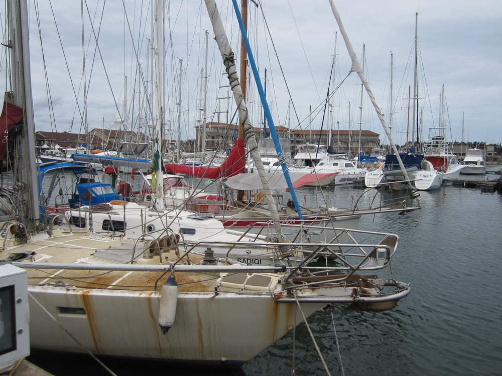
At 1530 on Friday, October 5  - departed Benguerra anchorage to head for Bob's Hole on the rising tide. Bob's Hole is a reasonably protected anchorage near Point Chissangune - the navigable gap between Benguerra Island and Bazaruto Island. Sadiqi was pushing against the current of the rising tide. There were a few nervous moments when the depth gauge only showed half a meter of water below the keel while navigating the channel. I'm indebted to Des at Sakatia for giving me the coordinates of the passage. The anchor was dropped at 1730 with out loosing paint off the bottom of the boat or crushing any crustaceans on the bottom of the keel.
Bob's Hole:
Lat: 21 48.97 S
Lon:  035 27.50 E
Southern end of Bazaruto
At 0500 on Saturday, October 6 I hauled anchor and headed to the gap - mindful of the hazards of the bar and navigating the gap on the rising tide.
Winds 10 to 12 knots Easterly.
1099.4 Engine hours.
Barometer: 1018 Mb.
Early morning washing machine - The Gap
 There was tremendous water turbulence in the centre of the channel. Something I would not have liked to have gone through. The waves in the channel tended to come from all directions, fortunately not very large. The wind increased slightly from the ENE to 12 to 15 knots making it easier to push against the incoming current. While the bar on the seaward side of the gap was shallow at 4 metres below the water the waves were not threatening.

After crossing the bar at 0700 the winds dropped to ENE 5- 8 knots and the waves were very sloppy and uncomfortable. The sails banged and crashed. The engine was restarted and Sadiqi tried to slice through the slop at 3 knots. I can only assume that the lousy, choppy uncomfortable waves were the result of the wind waves meeting the counter current heading north. The hunt was on for the elusive Mozambique Current.

At 0900 the waves were incredibly uncomfortable - short length and steep. The winds were also light. The sails were slatting so much that I pulled then down and Sadiqi bounced about like a cork motoring south west at 3 knots.

1100 the winds picked up to 6 to 10 knots - what a relief. Big Bertha was put up and the Engine was turned off.
Speed 4.5  and SOG 4 knots.

Noon 06-10-12 – Saturday
Time: 12.00L UTC+2.0 
Lat: 22 10.04 S
Lon: 035 37.91 E
COG: 175 Deg  M
Winds: 8 to 12  Kts NNE
Engine: 1103.6 Hrs
Distance covered since departing Bob's Hole 23.8  Miles.
Barometer: 1017 Mb.

1500 Winds 10 to 12 knots NNE.
Very pleasant downwind sailing with Big Bertha flying.
Speed 6.5 knots SOG 6.5 knots.
Current heading south in the right direction remains elusive.
Gull wing with Big Bertha
 1730 Winds dropping 5 - 10 knots NNE.
10 miles off the coast - maybe in the current. Boat speed and SOG mostly the same.
Dropped Big Bertha.
Poled out the Jib.
Speed 4.0 knots, SOG 4.5 knots.
Chef preparing Massaman curry on rice for dinner.

2100 Winds 6 -8 knots NE.
Speed 2.0 knots, SOG 2.0 knots.
Sails slatting and banging in lousy chop.
Raised Big Bertha.
Speed 3.8 knots, SOG 4.00 knots

It would appear that the lousy, choppy waves, that throw the boat around, mean we are in the vicinity of two opposing currents. The trick is to find the current that is going in the right direction.

2145 abreast Pomene - 5 miles off.

0030 Winds 5 - 10 knots NE.
Nice sailing with Big Bertha.
Speed 4.5 knots, SOG 4 knots.
10 miles off the coast.

0600 Wind 8 - 12 knots NE.
Big Bertha still flying
Speed 5.5 knots, SOG 5.2 knots
20 miles off the coast - still looking for that elusive south setting current.
18 miles north east of Inhambane
Barometer: 1016 Mb

0830 Winds 6 - 8 knots NE.
13 miles due east of Inhambane.
Speed 4 knots, SOG 4.4 knots.

Noon 07-10-12 – Sunday
Time: 12.00L UTC+2.0 
Lat: 24 02.76 S
Lon: 035 48.72 E
COG: 195 Deg  M
Winds: 6 to 8  Kts NE
Engine: 1103.6 Hrs
Distance covered since noon yesterday 113  Miles.
Barometer: 1018 Mb.
Speed 5.0 knots, SOG 5.5 knots.
Seem to have found the elusive current of about 0.5 to 1 knot south. 15 miles off the coast near Cabo Das Correntes.
In the elusive current
 1500 Wind 10 to 12 knots NE
Speed 6.5 knots, SOG up to 8 knots.
Pulled down Big Bertha - stressing the boat and the skipper - its not a race.
Poled out the Jib.
Speed 5 knots, SOG 6 knots

1700 Beer o clock. Winds 10 - 12 knots NE
Listened to weather forecast from Roy at Peri Peri Net. There was a risk of a small low pressure with winds SE to 30 knots near Inhaca/Maputo in the early hours of Monday morning.
Speed 5 knots, SOG 6 knots.

1800 Winds 12 - 15 knots NE.
Furled the poled out Jib and sail on mainsail only.
Speed 5 knots, SOG 6 knots.

2300 Winds 8 - 10 knots NE - dropping.
Barometer: 1016 Mb.
Speed 4.5 knots, SOG 4 knots.

0030 Monday Winds 5 - 8 knots NE
Lousy, sloppy waves. Sadiqi feels like she is being continually tripped up.
Speed 4 knots, SOG 3 knots.
Barometer: 1016 Mb.

0215 Winds 6 - 8 knots ENE.
Lat: 25 12.23 S
Lon: 035 22.58 E
Seas very confused choppy waves.
Speed 3 knots, SOG 3 knots.

0400 Winds 8 - 10 knots NE
No sign of low pressure - barometer going up.

0500 Wind picking up 10 - 12 knots SE
Very rough choppy seas.
Started engine.
Barometer: 1018 Mb going up.

0630 Winds 12 - 15 knots SE.
Speed 6 knots, SOG 6.5 knots, COG 270 degrees M.
We seem to have missed the low pressure with strong winds.

0730 Winds 12 - 18 knots SE
Speed 6 knots, SOG 7 knots, COG 160 degrees M.

Noon 08-10-12 – Monday
Time: 12.00L UTC+2.0 
Lat: 25 34.30 S
Lon: 034 32.44 E
COG: 280 Deg  M
Winds: 12 to 18  Kts NE
Engine: 1104.6 Hrs
Distance covered since noon yesterday122   Miles.
Barometer: 1018 Mb.
Speed 5.0 knots, SOG 5.5 knots.
Heading almost due west for Inhaca/Maputo.
Swell 3 to 4 meters - confused seas - bearable.

1700 Winds 12 - 18 knots SE
Speed 4.5 knots SOG 4.0 knots
Beer o clock.
Spoke to Roy and Paul on Peri Peri Net. Bad weather forecast for Wednesday, Thursday. At the time was 220 miles from Richards Bay. Even with the Mozambique Current, if I could find it, it would be too risky to attempt to beat the strong 38 knots south easterlies forecast.

2100 Wind 8 to 12 knots ESE
Nasty, sloppy waves.
Pushing against a one knot current.
Speed 4.0 knots, SOG 2.5 knots, COG 275 degrees M.

2330 Very uncomfortable in slop - going slow. Wind 6 to 10 knots ESE.
Smithy - Windpilot was not coping with steering down wind - too little wind.

0030 Wind 6 to 8 knots ESE.
Motion on board very uncomfortable - sails slatting and banging.
Pushing against current.
Started engine.
Speed 4.5 knots, SOG 4 knots, COG 270 M.

0530 Winds 5 to 10 knots ENE.
Still motoring!
Speed 4.5 knots, SOG 3.0 knots
Barometer: 1019 Mb

0600 Wind 5 to 10 knots ENE, COG 270 M.
Poled out the jib to try and get some boat speed to make the motion more comfortable.

0815 Winds 6 - 10 knots NE.
Sloppy seas - sails banging and slatting.
Its like listening to 100 dollar notes being torn apart. I already had to effect some repair to the mainsail where the batten pockets meet the luff.

There were many seabirds soaring the waves - large albatross, shearwaters, petrels etc.

Noon 09-10-12 – Tuesday
Time: 12.00L UTC+2.0 
Lat: 25 47.93 S
Lon: 033 02.30 E
COG: 260 Deg  M
Winds: 5 to 8  Kts NE
Engine: 1110.4 Hrs
Distance covered since noon yesterday82.5 Miles.
Barometer: 1020 Mb.
Speed 3.0 knots, SOG 2 knots.
Approaching the entrance to Maputo Bay.
Whale breaching
Close enough to frolicking whales
Heading toward Ilha Dos Portugueses I saw a tremendous splash in the distance. There was not enough swell to cause that sort of breaking wave splash on a reef. Then I saw a large whale breach and splash back into the water -  a phenomenal sight. I was not sure if they were Humpback whales or whales humping. Seeing, possibly, several tonnes of whale suspended in the air, momentarily defying gravity and splashing back to the water was truly amazing.

While approaching the area I wanted to anchor in several fish leapt out of with water toward the boat. Some of them flew over the cabin top and I had to duck to avoid being hit by another. Another landed in the cockpit sole and flopped about. I identified it as Wolf Herring, not a particularly good eating fish, apparently. The fish did not survive however, after having beaten it's head against a winch handle I happened to holding at the time.
Ilha Dos Portugueses
 1500 Arrive Ilha Dos Portugueses, Inhaca, Mozambique.
Engine 1112.2 hours.
Lat: 25 58.85 S
Lon: 032 54.16 E
Barometer 1016 Mb - falling.

Noon 10-10-12 – Wednesday
Time: 12.00L UTC+2.0 
Lat: 25 58.85 S
Lon: 032 54.16 E
Anchored
Engine 1112.2 hours.
Barometer: 1012 Mb falling.


1500 I hauled anchor and headed around the northern side of the island anticipating the south easterly blow that was due during the night. As I left I could barely make out the city of Maputo through the fug and haze toward the west.


The new anchorage to the north of Ilha Dos Portugueses:

Lat: 25 57.76 S
Lon: 032 54.83 E
Warning the C-map electronic charts show Ilha Dos Portugueses as larger than it actually is to the north west. Looking at Google Earth this may be caused by the north westerly part of the islands being washed away. The anchorage was a little rolly as the wind waves had not abated from the north east. That would quickly change once the south easterly blew in earnest.

1800 Winds 25 to 35 knots SSE.
The wind howled
Barometer: 1009 Mb
By 2200 hours the wind had started to abate.